Written by Janelle Rudolph
This fall has been unseasonably warm, with many days of the last week averaging 25°C, and that doesn’t seem to be changing anytime soon. Those who are looking to break out their thick sweaters and scarves might be waiting a while.

The entirety of British Columbia has been breaking temperature records this fall and has received far less rain than normal, with The Weather Network writing that the Mojave Desert has received more rain than the province in the last few months. Though this warm weather is being enjoyed by many, there are many questions about what’s going on and what effects this will have.
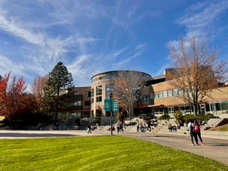
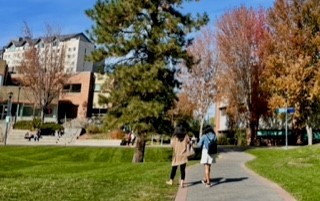
It’s mid-October, but when walking through the city of Kamloops many people are seen wearing shorts and sandals, and not wearing jackets. The average temperature of Kamloops in October is a mild 15°C, but this year that’s not the case with many days hitting the mid-20° mark. The many sunny, warm days with few clouds in the sky are wonderful but it also sparks climate anxiety and worries about what impacts this will have on the future.
“Weather is three dimensional,” Michael Flannigan, Chair of Predictive Services, Emergency Management, and Fire Science at Thompson Rivers University (TRU) and a trained meteorologist said. “The atmosphere is a fluid that is almost always moving. And with that movement, high pressures, low pressures move along.”
When the topic of the current warm weather was brought up, he explained that he shared in this worry. With over four decades of research experience on fire, weather, and climate he was able to explain why Kamloops – and the rest of British Columbia – is having such above-average temperatures.
Stuck in a ‘Ridge’
Global weather is a wave pattern, creating ridges and troughs with our daily weather being determined by what happens in the upper atmosphere. The flow of the atmosphere pushes high and low-pressure systems along which is what provides varying weather patterns.
“Right now… we’re getting what’s called a ‘blocking ridge’,” Flannigan said. “also called an ‘Omega block’ [because it looks] like the Greek letter Omega.”
Since B.C. is currently ‘in’ a ridge, the area is missed by any low-pressure systems. Low-pressure systems are those that carry precipitation, cloud cover, and cool weather, and the ridge creates a sort of barrier that forces these to go around to Northern or Southern areas. The result is an area that remains sunny, warm, and dry further perpetuating drought and fire, most extremely exemplified by California but also what is being experienced here in Kamloops and other areas of B.C..
“The fire season is still going; we still have active fires,” Flannigan said. “I never recall [active fires] in October. This is really strange.”
What’s Causing It?
B.C.’s current situation is a ripple effect of climate change and the damage done to the atmosphere. There are atmospheric jet streams that give direction to the pressure systems, with the jet streams gaining strength from temperature differences between the equator and the northern hemisphere. When there is less variance between these temperatures, jet streams are slowed down and create a more stagnant pattern of larger ridges and troughs. This situation will continue to increase as global temperatures increase.

“This is climate change driven,” Flannigan said. “and… we’re seeing more and more of these stagnant patterns.”
This is not a situation specific to B.C. or even Canada. The effects of these stagnant patterns can be seen across the world, all one must look for is extreme, ‘once in a lifetime’ weather events. For example, this past summer in England the country was hitting extreme high temperatures of 40°, never seen before, and there was monumental flooding this monsoon season in Pakistan, reaching levels not met in centuries. Flannigan explained that most weather events are based on the historical climate but with the increase of jet streams losing speed, occurrences classified as ‘rare’ will be happening more often.
“What used to be 1 in 100 years now is happening every 10 years, for example.”

This may have effects on future seasons as well. With less precipitation occurring in the fall, the soil can’t recharge its nutrients and gain the necessary ground cover to retain its nutrients. As Flannigan discussed, B.C. will need a few large storms in late fall and winter to regain its moisture. Otherwise, there could be a continuation of the drought in the coming spring.
What Now?
There is no way to push the area out of this ridge, the only thing to do is wait and let it follow its course. “Typical fall weather will come,” Flannigan promised. “The rains and snows will come. They’re just very delayed this year, and there’s nothing we can do about it.”
The continuation of this situation, and extreme weather events, may have detrimental effects on the environment and the economy. Lasting repercussions could present themselves as multi-year droughts and the need to adjust current agricultural practices to better fit a dryer climate. As Flannigan says, there needs to be a better handle on greenhouse gases to halt these effects on the atmosphere.

Leave a Reply